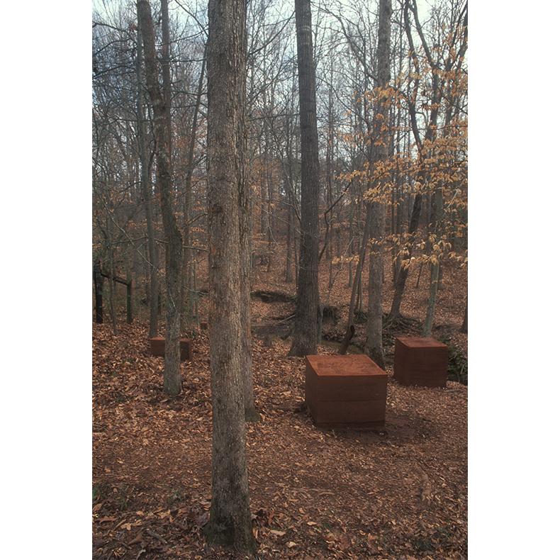
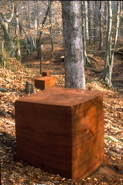
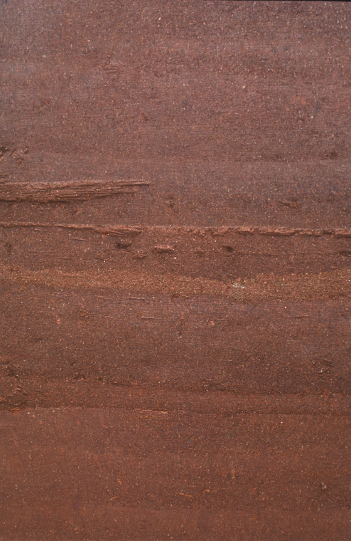
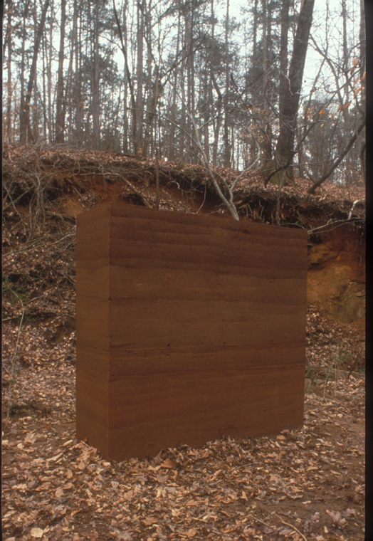
Invisible Operations
South Carolina Botanical Garden, Clemson, SC, 1999.
28 rammed earth geometric solids ranging in size from 1' square cubes to a wall 6'8" x 6' x 2', site: approx 1 acre.
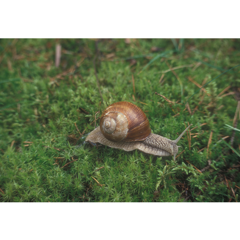
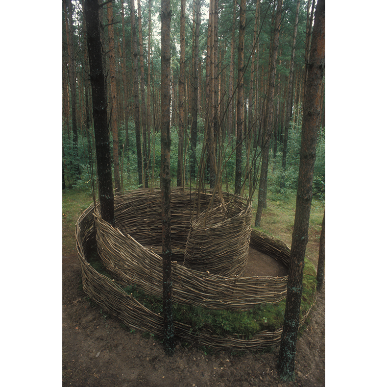
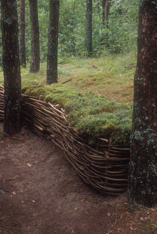
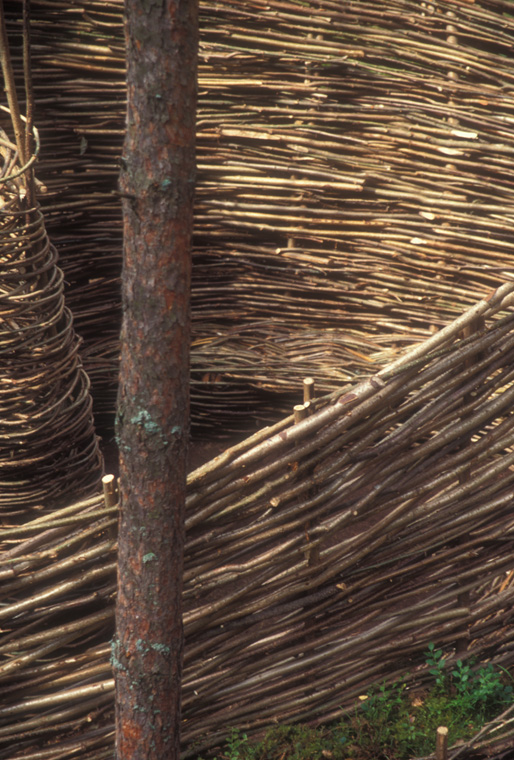
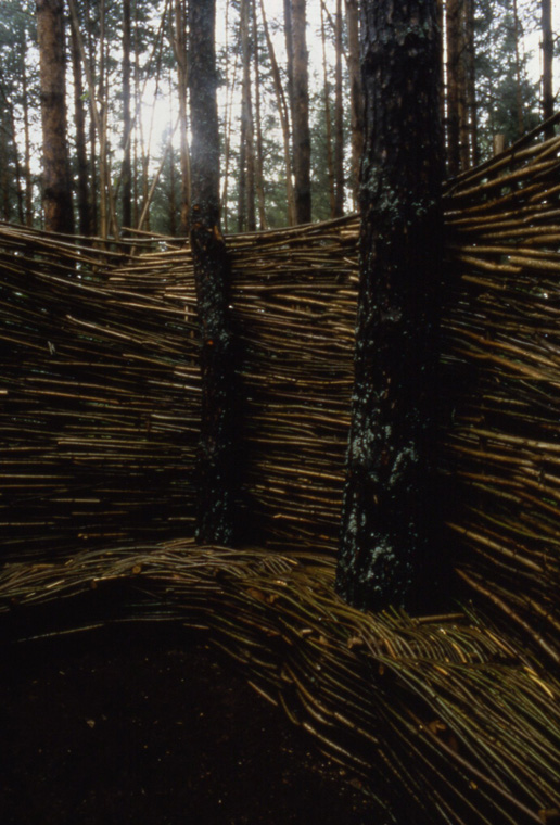
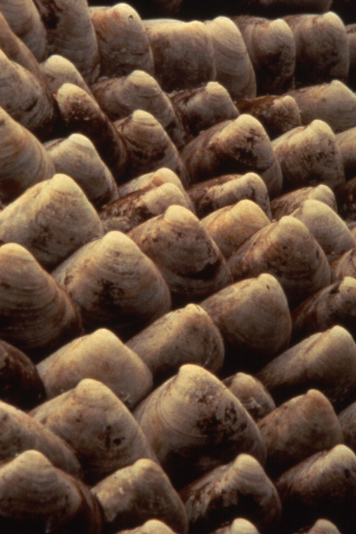
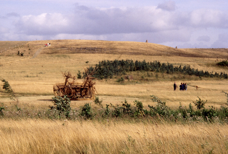
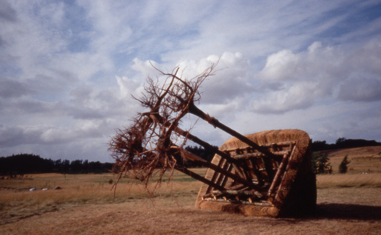
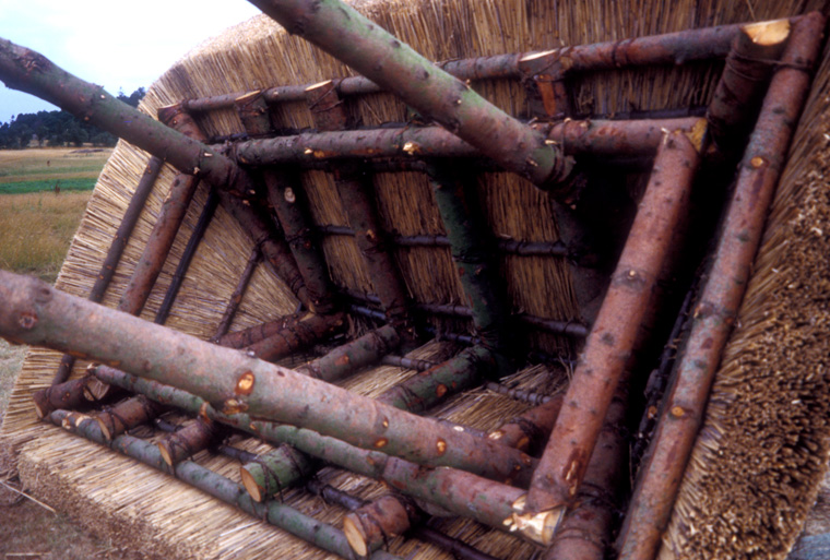
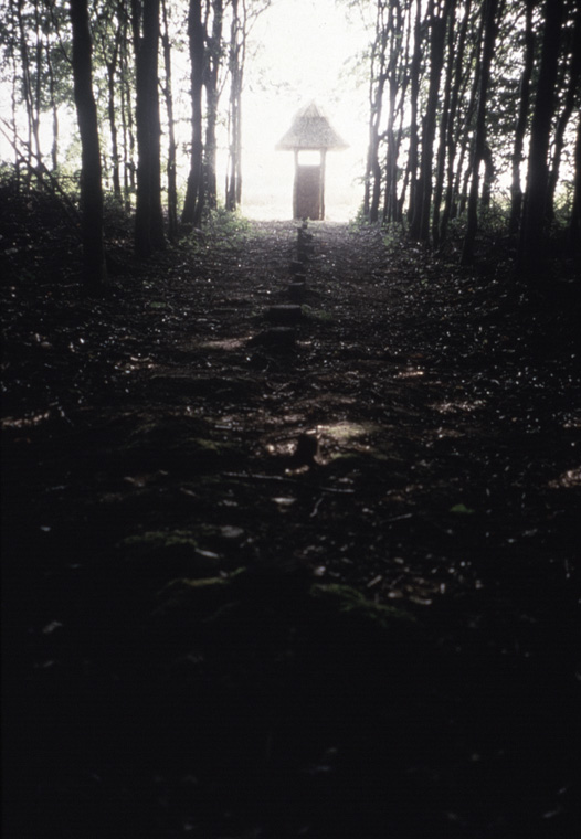
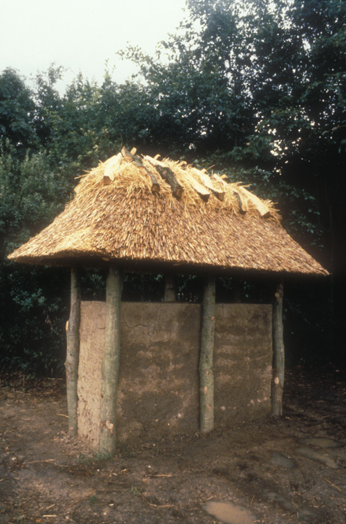
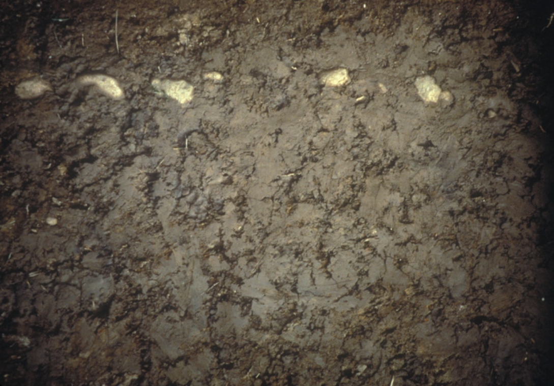
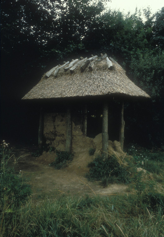
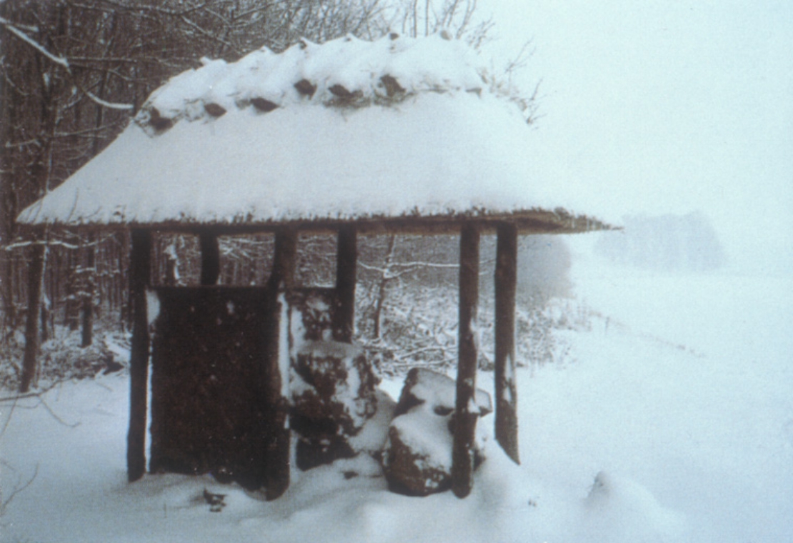
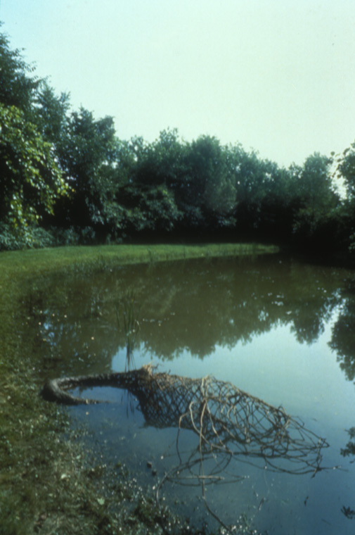
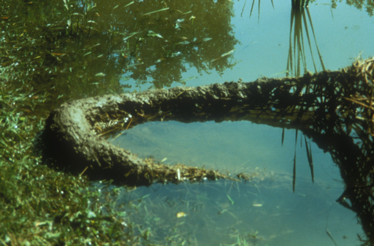
Space for Contemplating Lithuania...All the While the Snails Crawled
Europos Parkus, Vilnus, Lithuania, 1998
Hazelnut saplings, rammed earth with straw and flax, moss, 20 x 25 x 7.5' at highest point, (6.1m x 7.6m x 2.3m)
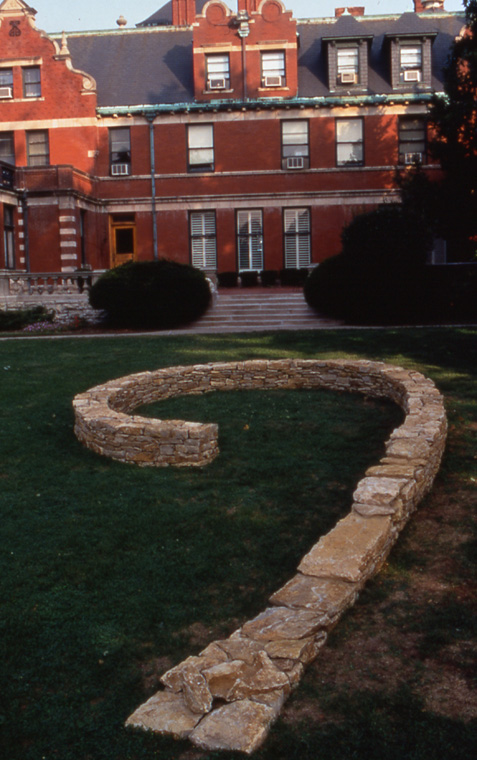
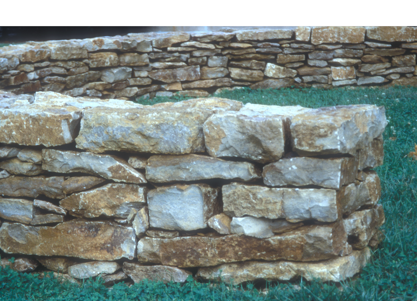
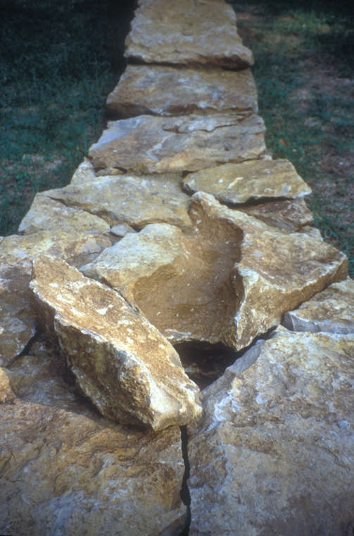
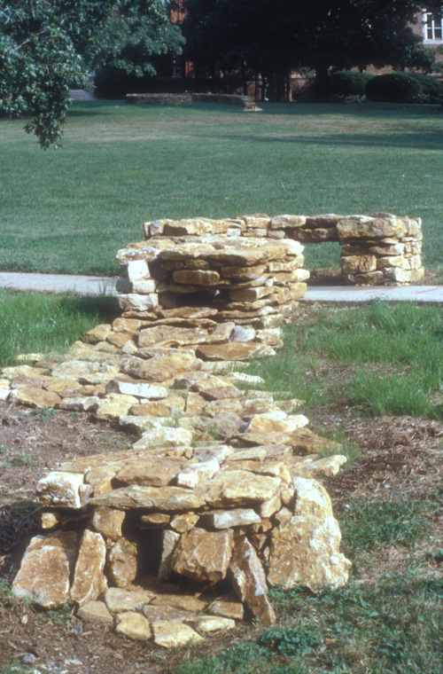
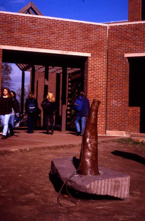
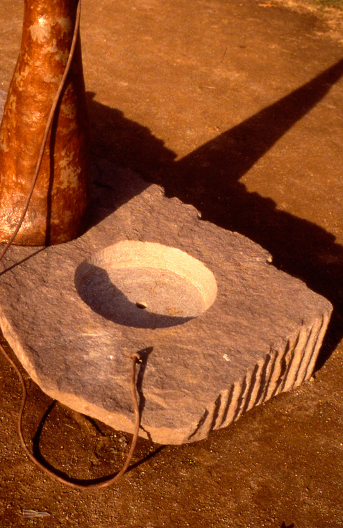
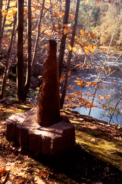
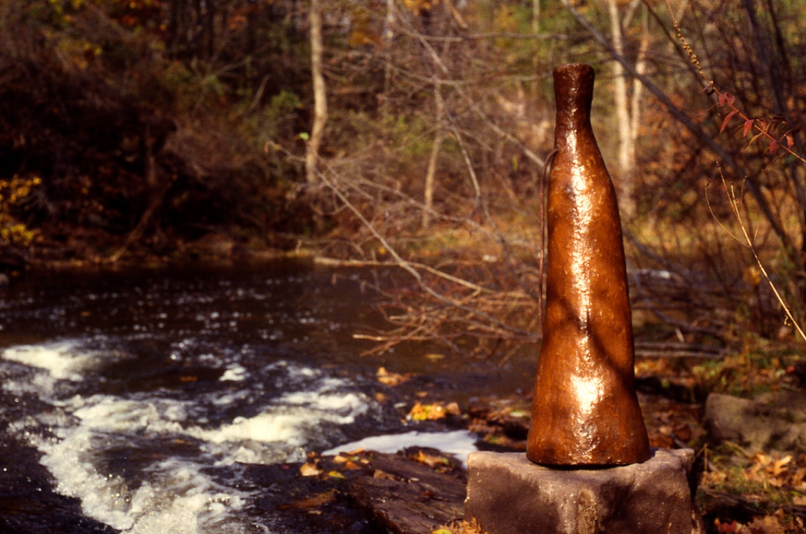
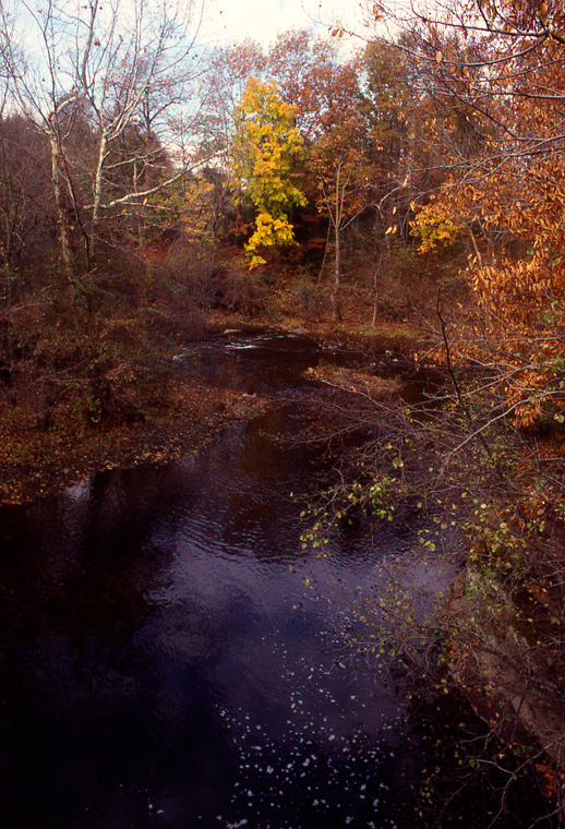
Flow
ArtScience Collaborative
(ASC = "ask) Karen McCoy and Don Wilkison, Hydrologist, for In Situ at Kansas City Art Institute, Missouri, 1998
Native limestone laid in dry stone technique, site approximately 1 acre
15' diameter x 17' L x 20" average width and 17" H in seating area.
Dedicated to the memory Eddie Vanderfrift, stonemason, and our teacher. Special thanks to Todd Grieve, KCAI Sculpture student.
Gallery installation: walls painted with found local earth pigments, indigenous materials and texts about the site.
Installation detail geology diagram drawn on wall, with stone, core samples and text, found local pigments.
Installation detail, with printed site map/guides, wall map, pigment swatches and complete information guide to the interns' research.
Installation detail, Census maps drawn with soil collected on site, land ownership 1875-present, 8 x 10" each on "Clayboard".
Detail, map of land ownership 1885, drawn with soil collected on site, 8 x 10" on "Clayboard".
Detail, map of land ownership 1945, drawn with soil collected on site, 8 x 10" on "Clayboard".
Detail, map of land ownership 1996, drawn with soil collected on site, 8 x 10" on "Clayboard".
Installation of prairie plants, above and underground (L) and of native plants with medicinal uses by the American Indians (R), with map and text concerning tribes that previously lived on the landscape around Salina, KS.
Detail of prairie plants, above ground and underground, with "roots" constructed by the artist using string, glue, natural latex rubber, soil, one sample burned to demonstrate prairie fires still used to control growth.
Flags, 24' T on fence rows, one mile x one mile.
Dug earth and flags, 5 x 5 x 2'.
Trail Marker/ Earth Core Sample extracted from exact site it marks, 4' x 2" diameter.
Cleared remains of drystone farmhouse cellar, with shelf containing hand and electric appliances, blender, electric mixer, electric can opener, whisk, grater, potato smasher and hand crank can opener.
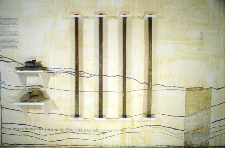
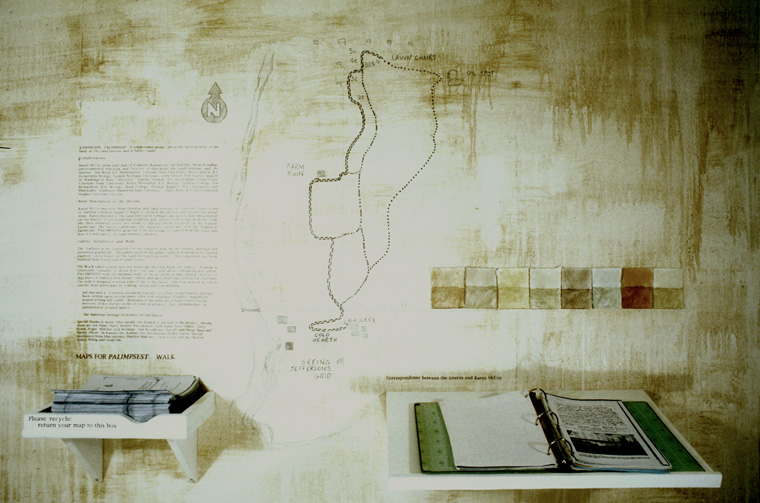
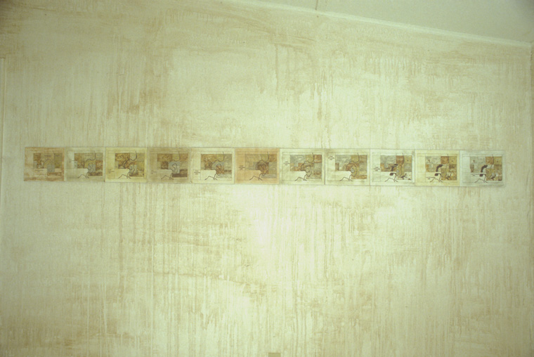
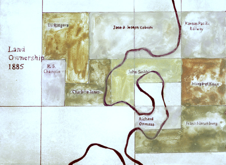
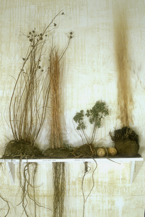
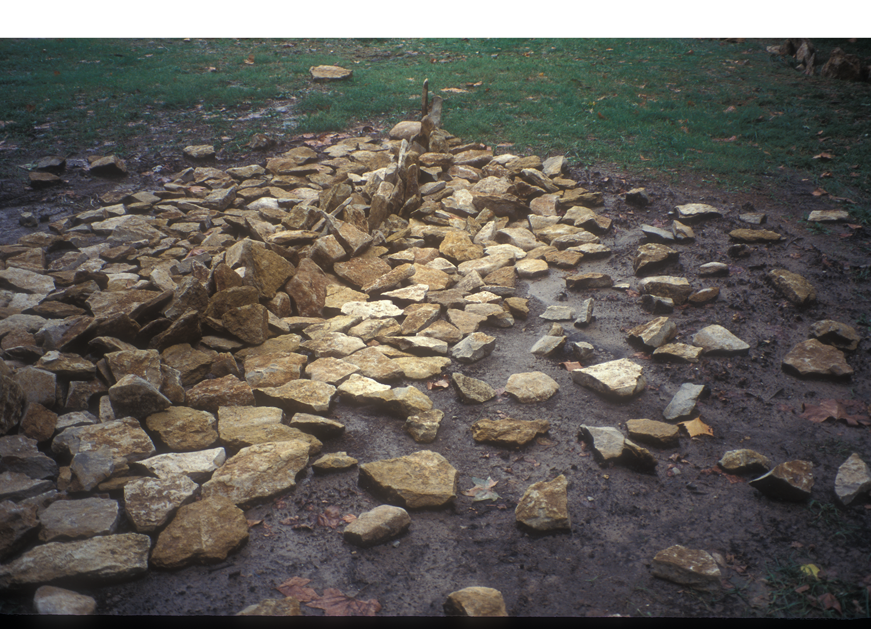
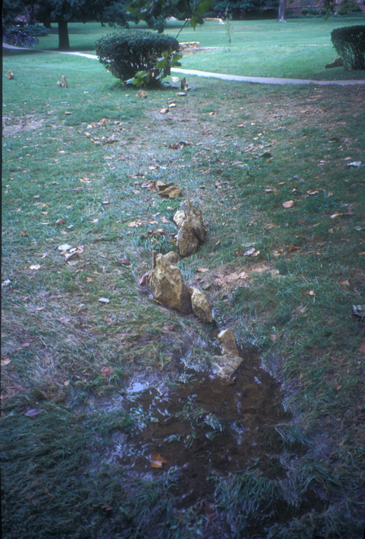
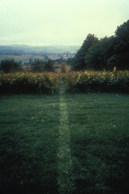
Landscape Palimpsest
Collaboration with Land Institute Environmental Historian and Director of Education, Brian Donahue and Interns.
Salina, Kansas, 1996
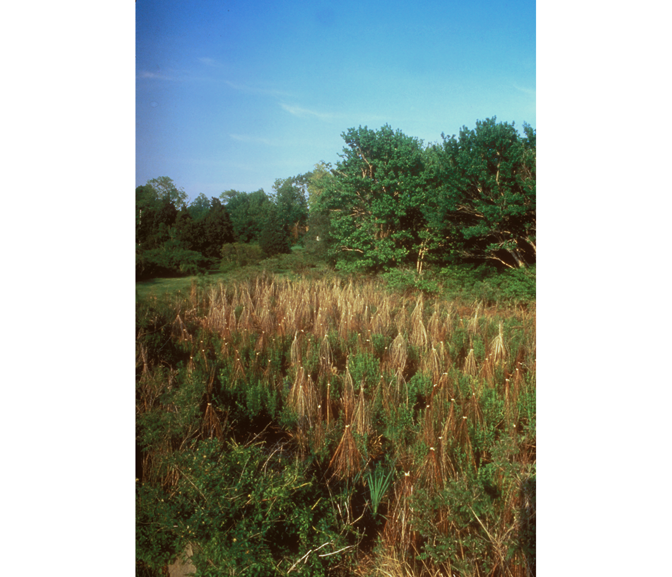
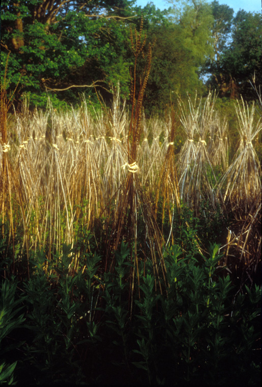
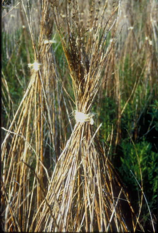
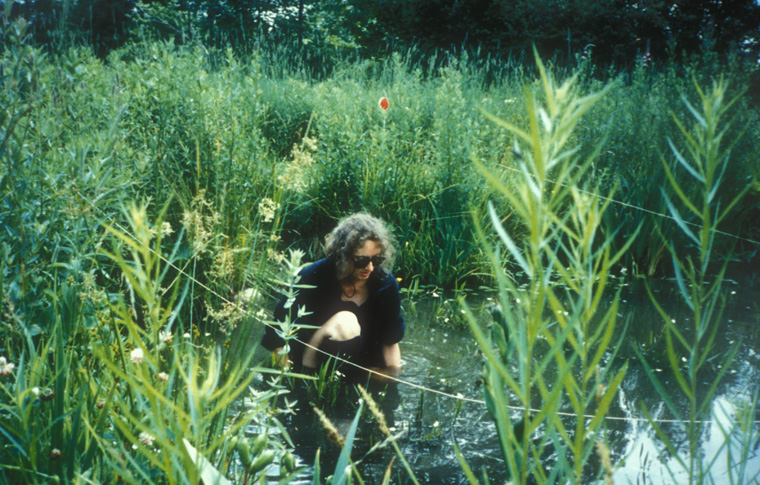
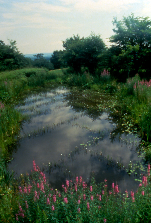
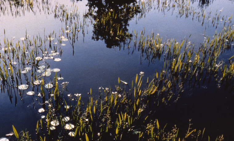
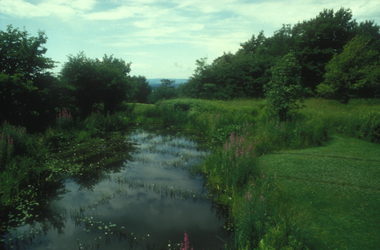
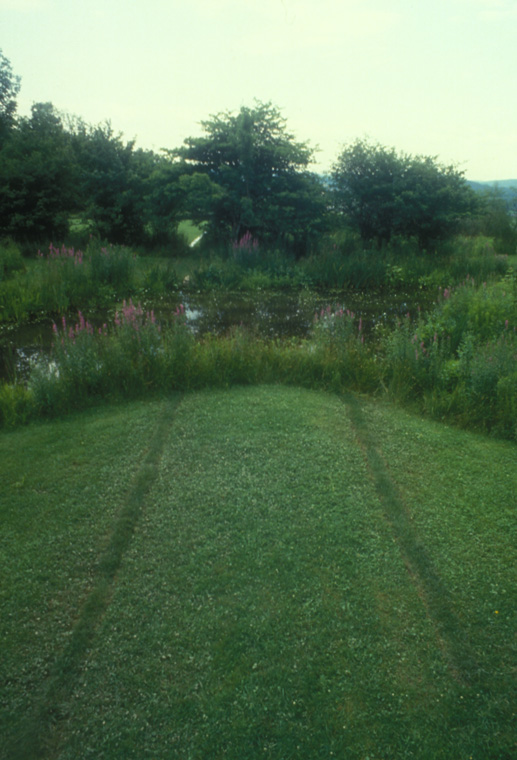
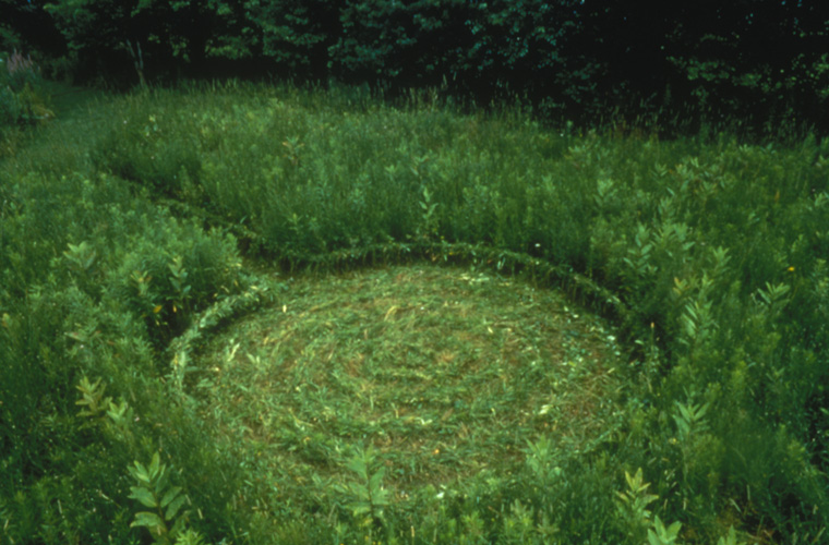
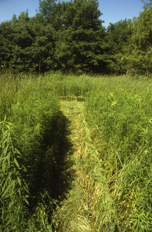
Sheaved Swamp
Blithwold Gardens, Bristol, Rhode Island, 1996
the past year's growth of Marsh Mallow and Purple Loosestrife tied with sisal twine, 100' x 150' x height of grasses
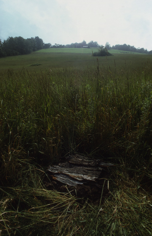
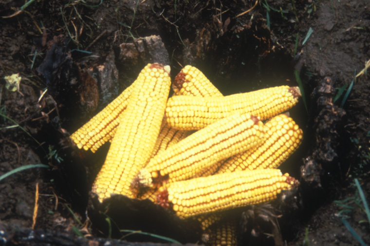
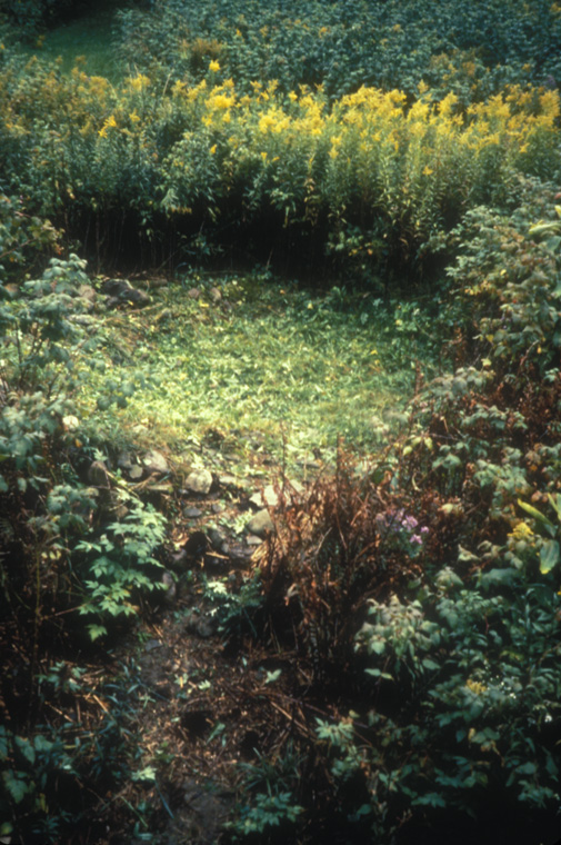
Site in plaza outside of Joseloff Gallery, sounds of traffic and voices bouncing off of architecture.
Detail of ear trumpet surface.
Site in plaza outside of Joseloff Gallery, sounds of traffic and voices bouncing off of architecture.
cliff site overlooking North Branch of Park River.
river’s edge site.
site view at the rivers edge
Ear Mapping
for "The Edge Of Town" exhibition, Harford Art School and the Joseloff Gallery, University of Hartford, Hartford, CT, 1995-6
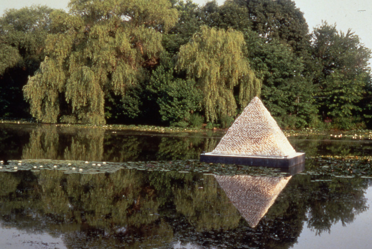
Floating Pyramid for a Consideration of Cultural Notions of Wealth and Value
Providence, RI, 1994
UPROOTED for exhibition Ex Natura II curated by Jørn Ronneau, Randers, (Jutland) Denmark. 1994, site view, wood, uprooted trees, thatched roof, 12 x 5 x10’.
Wood, uprooted trees, thatched roof, 12 x 5 x10’, carpentry: Jorgen Kristiansen (all joints notched and pegged) thatching assistance: Ian d’Revbenkil.
Detail interior.
Detail interior thatching.
Detail exterior thatching.
Sited in edge of damaged lake, North/South orientation. Wood thatched local reeds and heather, 9’9” x 4’8” x 8 H.
East /West approach path to hilltop site, planted beech forest found with one row removed, approximately 450’ x 10’.
Wood, thatched reads, wheat straw, mud (crop plants, wild fruits, native herbs in log, embedded within and resting on stone bed) 9.5x 5 x 8’.
Detail of rammed mud solid showing row of “ledeblck” (guide stones from glaclation) upon which embedded log rests.
Hilltop site after one year.
Hilltop site in snow, as it eroded in winter of 1994.
Lake site in snow, winter 1994.
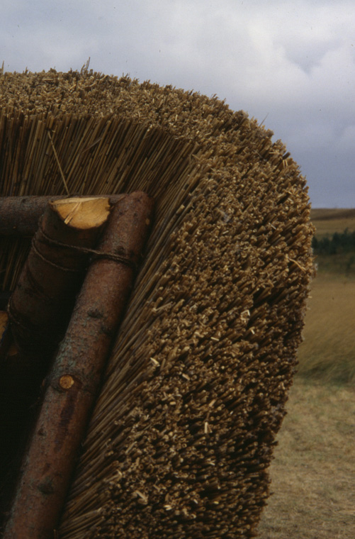
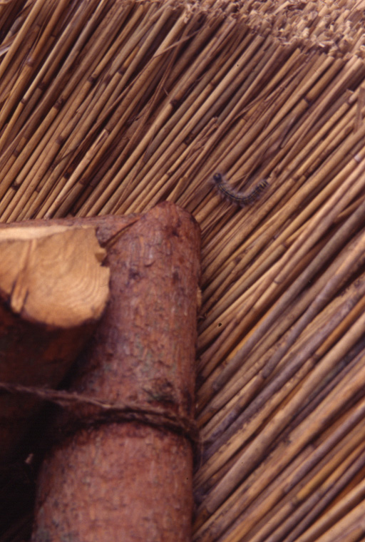
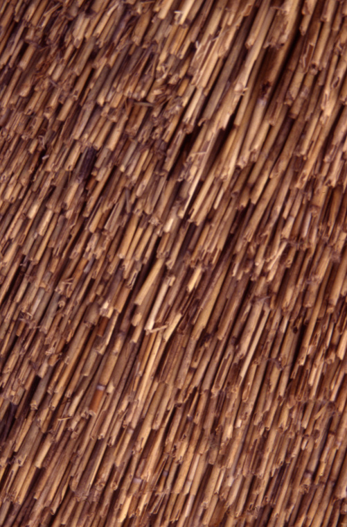
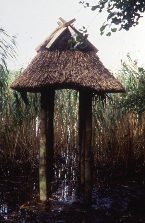
Structures for Discourse on Light and Shade
Tranekaer International Center for Art and Nature. Langeland, Denmark, 1993
Work-in-progress McCoy transplanting randomly growing Arrowhead Leaf plants.
View of gridded pond made by transplanting Arrowhead Leaf plants, 40’x50’.
Detail, Arrowhead Leaf plants in gridded pond.
Detail, of sod embedded in lawn to extend grid lines from pond and gridded pond.
Lines of Kentucky blue-grass sod embedded in the variegated lawn, extending grid in pond, each line show 9”x15’.
Cul de sac, braided growing meadow grasses, path, 15’ long x 2’ wide x circle 13’ diameter with 12”H woven edge
Dead end path, braided growing meadow grasses, 15’ long x 20” wide x12’ high.
Bleached grass/inverted sod sightline leading to view of agricultural landscape, 8” x 75’ (bleached line) and 16” x 75’ (inverted sod).
Corn pit effigy honoring Native American presence on site, pit lined with bark and filled with corn, 3’ deep x 18’ diameter, mowed site line rear ground.
Detail, interior of effigy corn storage pit.
View of cleared silo remains marking site of 1st pioneer, land owner Mary Hackley,, weaver and widow, 12’ diameter.
Canoe effigy (Iroquois dugout), woven grapevine with mud and grass, 9 x 2 x 3’
Detail, canoe effigy.
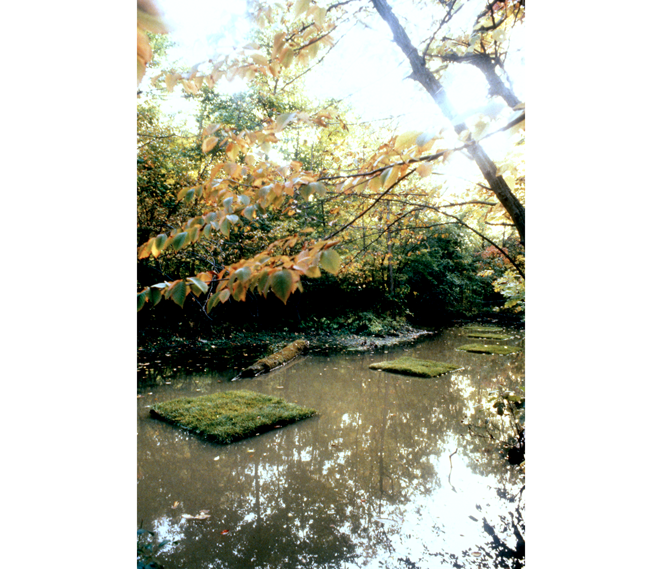
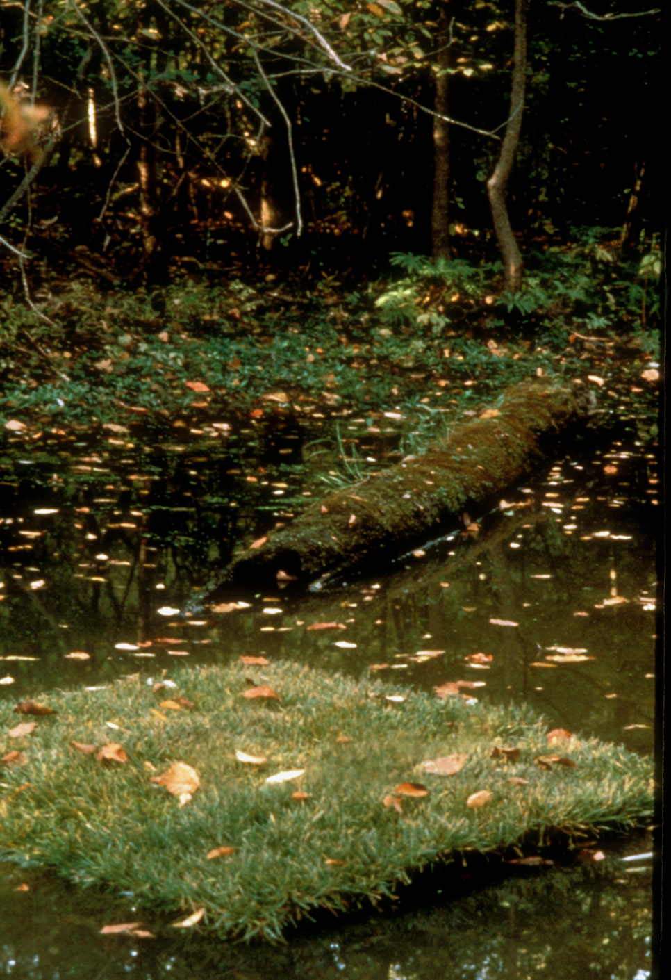
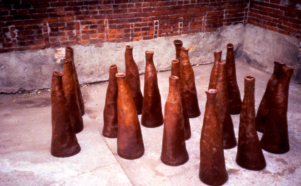
Perverse Cultivation
Project for Columbia Green Community College. Hudson, NY, 1992
Five sod covered wooden rafts floating, anchored, on creek, each 4' square.